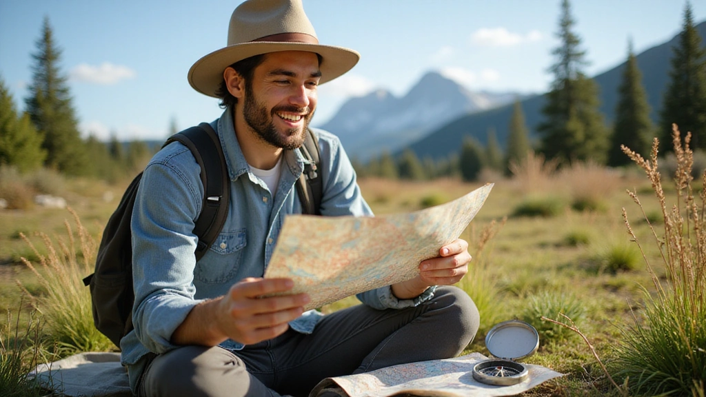
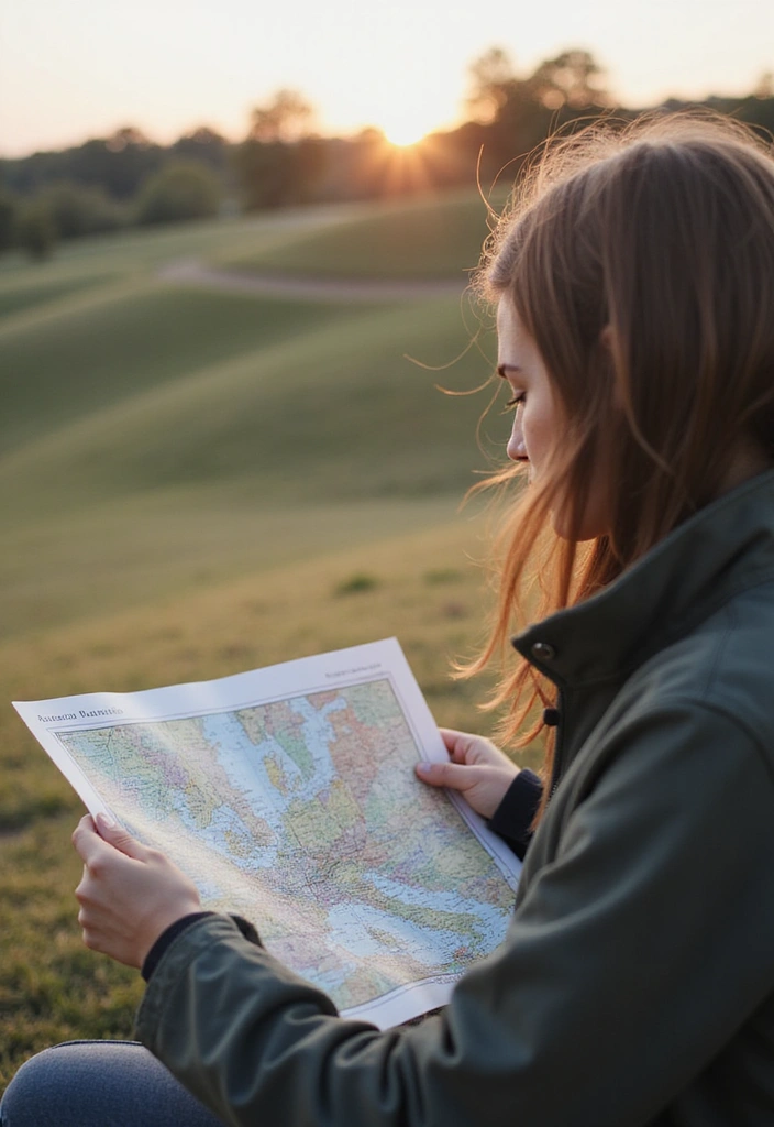
Embrace the adventure and equip yourself with essential navigation skills by mastering the art of map reading. Knowing how to read a map can turn even the most daunting journeys into exciting explorations. Whether you’re hiking through nature, traveling in a new city, or just wanting to impress your friends with your map skills, these simple steps will make you confident in any situation. Forget GPS for a moment and reconnect with the outdoors. By the end of this guide, you’ll be decoding map symbols and navigating like a seasoned pro!
Get ready to transform your travels and adventures with these easy-to-follow steps.
Contents
- 1. Understand Map Orientation
- 2. Learn the Symbols
- 3. Scale and Distance
- 4. Identify Contours and Elevation
- 5. Using Landmarks
- 6. Planning Your Route
- 7. Time Management
- 8. Practice Makes Perfect
- 9. Stay Calm and Adapt
- 10. Keep Learning
1. Understand Map Orientation
The first step to becoming a map-reading whiz is understanding orientation. Familiarize yourself with the basics: north, south, east, and west. Most maps have a compass rose showing direction, typically with north at the top. This knowledge is crucial as it helps you align the map with your physical surroundings.
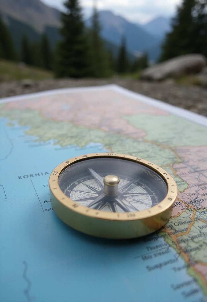
To enhance your navigation experience, consider investing in a compass. A reliable compass can be your best friend in the wilderness, ensuring that you always know which direction you’re heading, even when there are no visible landmarks.
Take a moment to practice orienting your map. Stand in the spot you want to navigate from, hold the map flat, and rotate it until the north on the map matches the direction you are facing. This simple skill allows you to see where you are and where you want to go.
For a more in-depth understanding of different terrains and landscapes, you might find a topographic map like the Hubbard Scientific 3D United States Map particularly useful. This raised relief map provides a tactile experience of the terrain, which can be quite beneficial when trying to visualize your surroundings.
Quick tips for mastering orientation:
– Use landmarks: Identify tall buildings or natural features.
– Trust your compass: The compass is an essential tool for navigation.
– Practice regularly: Consider using a map during hikes or city strolls to hone your skills. A map reading guide book can also provide valuable insights to help you improve your skills.
Understanding how to correctly orient your map will set the stage for all your future navigation adventures!
2. Learn the Symbols
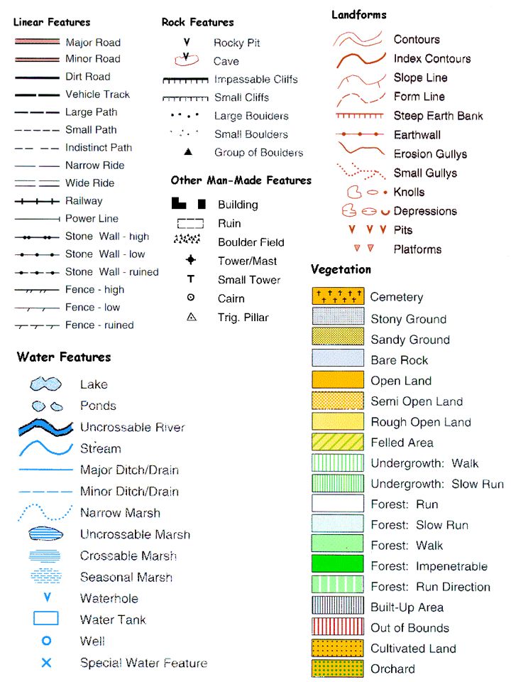
Maps communicate a lot through symbols. From roads and trails to parks and points of interest, understanding these symbols is key to reading a map effectively. Each map may have a legend or key that explains its specific symbols, so always take a moment to review this section.
Common map symbols include:
– Solid lines for main roads
– Dotted lines for trails
– Icons for restrooms, viewpoints, and campgrounds
– Different colors indicating water bodies, forests, or urban areas
Getting familiar with these symbols will help you navigate with ease. One handy resource is the topographic symbols – FM 21-31 US Army Field Manual (1952 civilian reference edition), which serves as a detailed cheat sheet featuring over 200 symbols for map reading. Having this on hand can boost your confidence as you learn.
Quick tips for learning symbols:
– Carry a small cheat sheet until you memorize them.
– Use online map resources to compare different symbols.
– Practice reading various maps, like hiking maps, city maps, and tourist maps, to see how symbols differ. For those interested in hiking, picking up a copy of Backpacking Oregon: From River Valleys to Mountain Meadows can provide practical map guidance and familiarize you with hiking symbols specific to the area.
The more you know, the easier map reading will become!
3. Scale and Distance
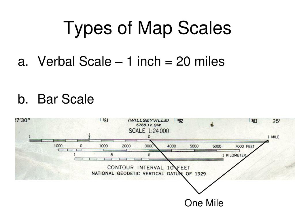
Understanding the scale of a map is vital for estimating distances. The scale tells you how much distance on the map corresponds to real-world measurements. It can be presented as a ratio (e.g., 1:50,000) or with a graphic scale bar.
To measure distances:
– Use the scale to calculate how far two points are from each other.
– For accurate travel plans, understand that different terrains can affect travel time.
– Always consider the scale when navigating unfamiliar territory.
Remember that larger scale maps show more detail but cover less area, while smaller scale maps cover wider regions but with less detail.
Quick tips for managing scale:
– Mark distances on your map for quick reference.
– Familiarize yourself with common distances through practice walks.
– Adjust your travel expectations based on the terrain.
For those looking to enhance their map reading skills, the U.S. Army Guide to Map Reading and Navigation is a great resource. This guide offers practical advice on understanding scales and distances, helping you navigate more confidently.
Mastering the scale can make a huge difference in your navigation confidence!
4. Identify Contours and Elevation
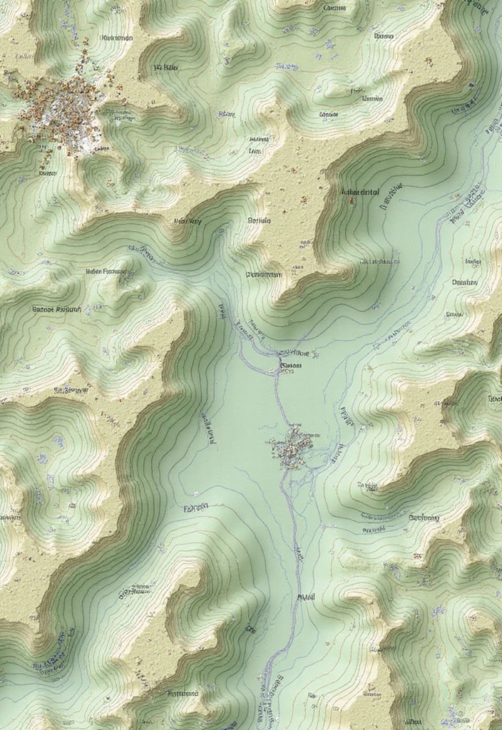
Contour lines on topographic maps indicate elevation changes, and understanding these lines is key to visualizing the terrain. Closely spaced lines mean steep hills, while wider spaces indicate flatter areas. This knowledge is particularly useful for hikers or anyone exploring mountainous regions.
Use contour lines to:
– Determine how steep a path is before you start, which can help you decide on a safe and manageable route.
– Identify plateaus or depressions in the land, allowing for better planning of your adventure.
– Plan your route to avoid unexpectedly steep climbs, ensuring a more enjoyable experience on the trails.
To enhance your skills in interpreting elevation:
– Practice reading contour lines on various maps, which helps build your confidence and understanding.
– Consider using the topographic map reading guide, a comprehensive resource that can aid in mastering these essential navigation skills.
– Use elevation to inform your physical preparation for hikes, ensuring you’re ready for the demands of the terrain.
– Always assess nearby terrain for a complete understanding of your journey ahead; a portable compass, like this portable compass, can help you maintain your bearings while on the move.
Mastering contour lines can significantly elevate your navigation game, and for those serious about their hiking adventures, a device like the hiking GPS device can be invaluable. It offers real-time data about your location and surroundings, helping you stay on track even in challenging terrains. Enjoy your explorations with confidence!
5. Using Landmarks
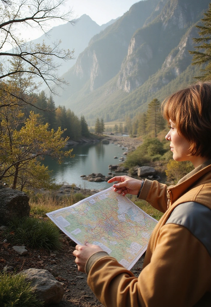
Landmarks are your best friends while navigating. These can be natural features like mountains, rivers, or man-made structures like buildings and bridges. When you can connect the symbols on your map with what you see around you, it creates a much clearer navigation experience.
To effectively use landmarks:
– Cross-reference them with your map to confirm your location.
– Use unique landmarks to keep track of your progress.
– Always have a backup plan in case your landmarks are not visible.
One great way to enhance your navigation skills is by using tools like the compass. This handy device helps you maintain your bearings, especially when you’re trying to line up your surroundings with the map.
Helpful tips for landmark navigation include familiarizing yourself with the area before heading out and making a mental note of key landmarks during your route. If you’re venturing into a new area, consider taking photographs to help remember your navigation points. Additionally, having a solid understanding of map reading can be immensely beneficial, so check out the Map Reading Guidebook. This resource will arm you with skills to effectively interpret your map alongside the real-world features.
For longer trips or more detailed navigation, a portable GPS device can really enhance your experience. With features like real-time spoken directions, it allows you to focus more on your surroundings and the landmarks you’re passing, ensuring you stay on track.
Connecting symbols to real-world landmarks can transform a map into a practical tool!
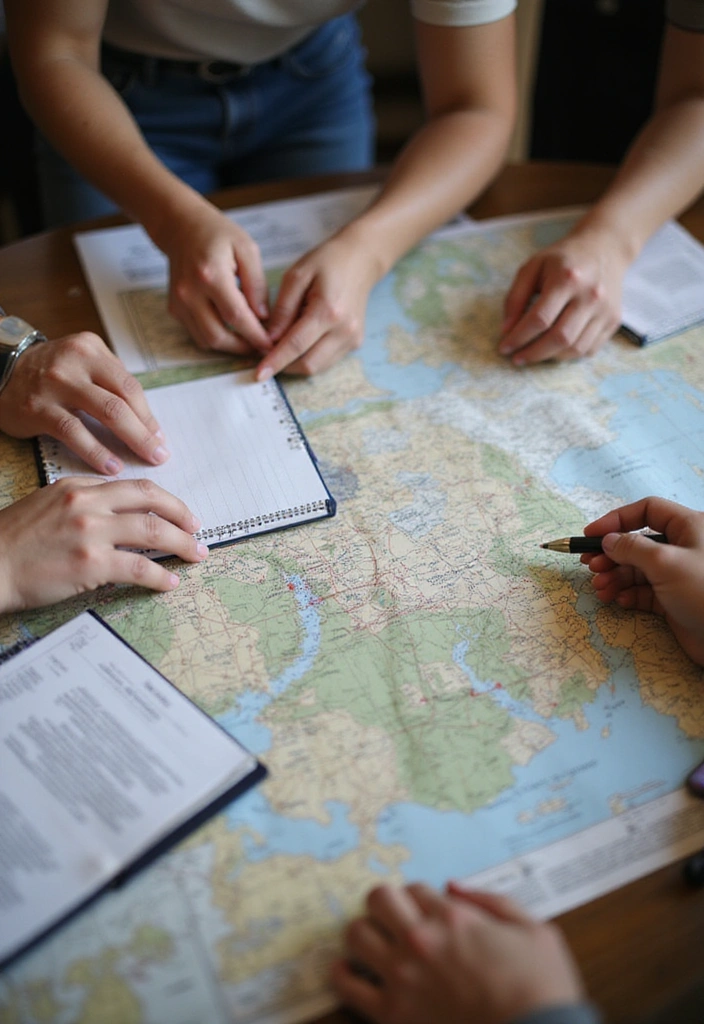
6. Planning Your Route
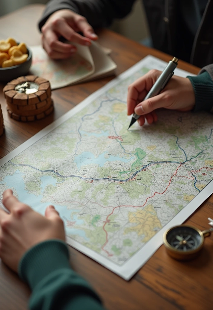
Before you embark on an adventure, having a solid route plan is essential. Determine your starting point, destination, and potential waypoints along the way. This can prevent confusion and help you stay on track.
When planning your route, consider:
– The types of terrain you will encounter (this can affect your travel time).
– Points of interest you might want to see along the way.
– Alternate routes in case of obstacles.
To enhance your planning, you might want to check out a topographic map. This Hubbard Scientific 3D United States map offers a detailed raised relief design that allows you to feel the terrain, helping you visualize your journey better.
For navigation, consider carrying a reliable compass like the 1985 Carabiner Compass. It’s a classic tool that can help you maintain your bearings, especially in areas where electronic devices might falter.
If you’re looking for a more modern approach, a portable GPS device could be invaluable. This device features a 7-inch touch screen with real voice spoken turn-by-turn directions, making it easier to navigate unfamiliar roads and trails.
Planning tips:
– Draw your route on a paper copy of the map to make it easier to follow.
– Check for trail conditions or road closures before heading out.
– Use applications or websites that help plan routes for additional insights.
With a good plan and the right tools in hand, you’re less likely to feel overwhelmed during your journey!
7. Time Management

While navigating, managing your time is just as important as knowing your route. Different terrains might require different travel times, so always factor in breaks, elevation changes, and the weather.
For effective time management, consider these tips:
– Estimate travel time based on distance and terrain.
– Schedule breaks to rest and take in the surroundings.
– Keep an eye on the sunset and adjust your plans to avoid navigating in the dark.
To help you stay on track, a reliable timepiece like the multi-function digital watch can be invaluable. Its features, such as a daily alarm and a stopwatch, ensure you stay aware of your schedule while enjoying your adventure.
Another handy tool is the portable travel timer. This easy-to-use timer is perfect for setting intervals during your journey, allowing you to manage your time effectively during breaks or when exploring new locations.
Set check-in points along your route to assess progress, and remember to stay flexible; sometimes, the best memories come from unexpected detours!
Effective time management can make all the difference in your adventure, keeping your experience enjoyable and safe.
8. Practice Makes Perfect
Like any other skill, practice is key to mastering map reading. Try using maps in different environments, whether it’s a city, park, or wilderness. The more you practice, the more comfortable and skilled you will become.
To enhance your practice, consider using the U.S. Army Guide to Map Reading and Navigation. This comprehensive resource offers valuable insights into topographic map reading, helping you understand how to interpret various map features effectively.
You might also find it beneficial to use a reliable compass, such as the TurnOnSport Orienteering Compass. This advanced scout compass is ideal for hiking, camping, and backpacking, making it a perfect companion as you explore different terrains and practice your navigation skills.
Additionally, if you want a fun way to engage with map reading, check out the Outdoor Kids Activity Book on Navigation. This workbook includes interactive activities like word searches and challenges, which can be both entertaining and educational for learners of all ages.
Here are some quick tips for practicing:
– Try reading a map without GPS assistance for a challenge.
– Take on different types of maps to broaden your skills.
– Ask friends to quiz you on map symbols and routes.
With dedication and practice, along with these helpful resources, you can develop confidence and proficiency in navigating any landscape!
9. Stay Calm and Adapt
Navigating can sometimes lead to unexpected challenges. Whether you take a wrong turn or face bad weather, staying calm and adapting to the situation is crucial. Fear and stress can cloud judgment, so always approach map reading with a clear mind.
Here’s how to stay calm:
– Take deep breaths and reassess your surroundings.
– Check your map against the environment to see where you might have gone wrong.
– Don’t hesitate to backtrack if needed.
To make sure you’re prepared for anything, consider a weather-resistant map case to protect your map from the elements. This will ensure that your navigation tools are always legible, even in adverse conditions.
Adaptation strategies include:
– Be open to taking a different route if obstacles arise.
– Use your resources, like asking locals for guidance.
– Keep your gear handy that might help in unexpected conditions.
A portable compass can be incredibly useful when you need to recalibrate your direction. It’s a simple yet effective tool that can give you confidence when navigating unfamiliar areas.
Additionally, if you’re venturing into more complex terrains, a multi-tool with navigation features could enhance your navigation skills. It includes tools like a ruler and divider that can help you read maps with precision.
Remember, a positive attitude can make any navigation experience enjoyable!
10. Keep Learning
Map reading is a skill that never stops evolving. New technologies and map types are constantly emerging, so keeping up-to-date with the latest trends can enhance your navigation skills. Consider exploring online forums, books, or courses to expand your knowledge.
One fantastic resource is Map Reading and Navigation for Dummies. This book can provide you with a solid foundation and help refine your understanding of map techniques, giving you the confidence to navigate like a pro.
To further enhance your skills, you might want to look into practical tools like the Garmin GPSMAP 67i Rugged GPS Handheld. With features like inReach® satellite technology and two-way messaging, this device combines traditional map reading with cutting-edge technology, making it easier to stay oriented in even the most remote locations.
Additionally, consider investing in a high-quality map for your travels, such as the National Park Travel Map Wood. This map can inspire your next adventure and provide detailed insights into the landscapes you wish to explore.
Ways to keep learning include:
– Follow blogs or channels focused on outdoor adventures and navigation.
– Attend local workshops to learn different mapping techniques.
– Experiment with digital maps to understand the integration of technology into navigation.
Learning doesn’t stop after you have mastered the basics. Stay curious, and you’ll discover new ways to enhance your map-reading prowess! Expanding your skills will not only refine your abilities but also make your adventures even more exciting!
Conclusion

Congratulations! You’re now equipped to read a map like a pro. Each step has brought you closer to navigating with confidence and ease. Remember, the key is practice and patience. Embrace your new navigation skills, and don’t shy away from adventure! Happy exploring!
Feel free to share your own tips or stories about map reading as you continue your exploration journey.
Note: We aim to provide accurate product links, but some may occasionally expire or become unavailable. If this happens, please search directly on Amazon for the product or a suitable alternative.
This post contains Amazon affiliate links, meaning I may earn a small commission if you purchase through my links, at no extra cost to you.